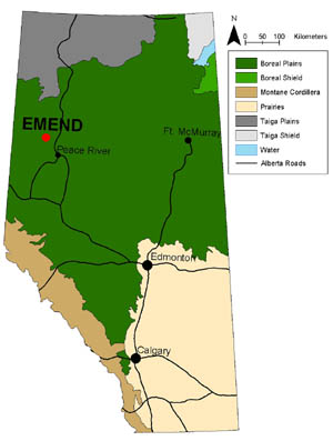
The EMEND research study site is located in the Clear Hills Upland, Lower Foothills Ecoregion of Alberta, approximately 90km north-west of Peace River. The site area is characteristic of the boreal mixedwood plains.
Project Size
EMEND in one of the largest projects of its kind in North America.
Experimental compartments = 1000 ha
(100 compartments x 10 ha each)
Land description
DMI P2 forest management area, Townships 89 & 90 Range 03 W6M
Coordinates
Following coordinates are for approximate project center:
56° 46′ 13” N -118° 22′ 28” W
UTM 0415986 6292662
Elevation Range
677 m to 880 m
Forest Stand Types
- Deciduous Dominated: = > 70% Deciduous (broadleaf) species (primarily trembling aspen)
- Conifer Dominated: = > 70% conifer (primarily white spruce)
- Mixedwood: 40-60% conifer and broadleaf (spruce and aspen) cover in the canopy
- Deciduous with Spruce Understory: = > 70% Deciduous (broadleaf) over white spruce understory
Tree Composition
Dominant tree species are:
- Populus tremuloides (Trembling Aspen)
- Populus balsamifera (Balsam Poplar)
- Picea glauca (White Spruce)
These species are also found in some stands:
- Picea mariana (Black Spruce)
- Abies balsamea Balsam Fir)
- Pinus contorta (Lodgepole Pine)
- Betula papyrifera (Paper Birch)
Understory Shrub Composition
The most common understory shrubs are:
- Viburnum edule (Low bush Cranberry)
- Rosa acicularis (Prickly Rose)
- Shepherdia canadensis (Canada Buffaloberry)
- Alnus crispa and A. tenuifolia (Green Alder and River Alder)
Soils
The soils at EMEND are fine-textured, formed predominantly on glacio-lacustrine deposits. A detailed analysis and description of EMEND soils can be found in Kishchuk 2004.